Links
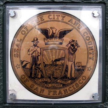
City of San Francisco
San Francisco Convention and
Visitors Bureau
San Francisco Chronicle
"San
Francisco/Napa, March 2009" Big Map Blog Entry, April 3, 2009
"Northern
California, March 5-17, 2010" Big Map Blog Entry, July 26, 2010
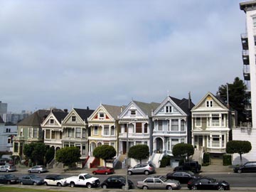
- Postcard Row (added 8/25/08)
- Alcatraz Island Cellhouse (added 8/25/08)
- Alcatraz Island Ferry (added 8/25/08)
AT&T Park (added 8/25/08)
BART (Bay Area Rapid Transit) (added 8/25/08)
- 924 Gilman Street (added 4/3/09)
- Chez Panisse (added 8/25/08)
- Shattuck Avenue (added 8/25/08)
- University of California-Berkeley
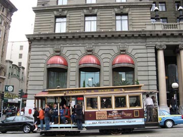
San Francisco Cable Cars (added 8/25/08)
The Castro (added 8/25/08)
- Golden Gate Fortune Cookie Factory (added 8/25/08)
- Grant Avenue (added 8/25/08)
- Jack Kerouac Alley (added 8/25/08)
- Waverly Place (added 8/25/08)
- City Hall (added 8/25/08)
- James Lick Pioneer Monument
- United Nations Plaza
Daly City:
- Koi Palace (added 4/3/09)
- Blue Bottle Coffee Company Cart (added 8/25/08)
- The Embarcadero (added 8/25/08)
- Ferry Building (added 8/25/08)
- Ferry Plaza Farmers Market (added 8/25/08)
- Fog City Diner (added 8/25/08)
- Gandhi Statue
- Justin Herman Plaza (added 4/3/09)
- Miette Pâtisserie
- Pancho Villa Taqueria (added 8/25/08)
- Pier 14 (added 8/25/08)
- The Slanted Door (added 8/25/08)
San Francisco Feed (added 8/25/08)
Financial District:
- Hotel des Arts (added 8/25/08)
- Rincon Center
- Yank Sing (added 8/25/08)
- Alioto-Lazio Fish Company (added 8/25/08)
- Boudin Bakery (added 8/25/08)
- Fisherman's Wharf
- Ghirardelli Square (added 8/25/08)
- Jefferson Street (added 8/25/08)
- Pier 39
- San Francisco Maritime National Historical Park (added 8/25/08)
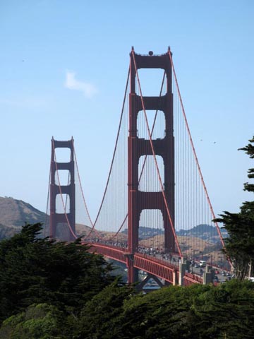
Golden Gate Bridge (added 8/25/08)
- Amoeba Music (added 8/25/08)
- Haight and Ashbury Streets (added 8/25/08)
- Panhandle (added 8/25/08)
- Citizen Cake (added 8/25/08)
- Hayes Green (added 8/25/08)
- Zuni Cafe (added 7/26/10)
- Osaka Way (added 8/25/08)
Lands End (added 7/26/10)
- Chestnut Street (added 7/26/10)
- Motel Capri
Market Street (added 8/25/08)
- Dolores Park (added 8/25/08)
- La Espiga De Oro (added 9/26/12)
- Maxfield's House of Caffeine (added 8/25/08)
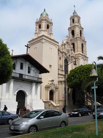
- Mission Dolores (added 8/25/08)
- Needles and Pens (added 8/25/08)
- Taqueria Cancun (added 7/26/10)
- Taqueria El Farolito (added 4/3/09)
San Francisco MUNI (added 8/25/08)
- Huntington Park (added 8/25/08)
- Broadway (added 4/3/09)
- Columbus Avenue (added 9/26/12)
Oakland:
- Crissy Field (added 4/3/09)
- Fort Point (added 4/3/09)
- Golden Gate Overlook (added 8/25/08)
Richmond District:
- Geary Boulevard (added 7/26/10)
- Lombard Street (added 8/25/08)
San Francisco International Airport (added 8/25/08)
San Francisco-Oakland Bay Bridge (added 8/25/08)
San Francisco Sidewalks (added 8/25/08)
- America's Best Value Inn & Suites (added 9/26/12)
- Bloodhound (added 9/26/12)
- Good Hotel (added 4/3/09)
- Mission Street (added 4/3/09)
- St. Joseph's Church (added 8/25/08)
- San Francisco Federal Building (added 4/3/09)
- Sightglass Coffee (added 9/26/12)
- Westfield San Francisco Centre (added 4/3/09)
- Yerba Buena Gardens (added 4/3/09)
- Coit Tower (added 8/25/08)
- Filbert Steps (added 8/25/08)
- Bourbon & Branch (added 4/3/09)
- Brenda's French Soul Food (added 4/3/09)
- Dottie's True Blue Cafe (added 8/25/08)
- Eddy Street (added 7/26/10)
- Golden Gate Theatre
- Hibernia Bank
- Olive Bar and Restaurant (added 7/26/10)
- Phoenix Hotel (added 8/25/08)
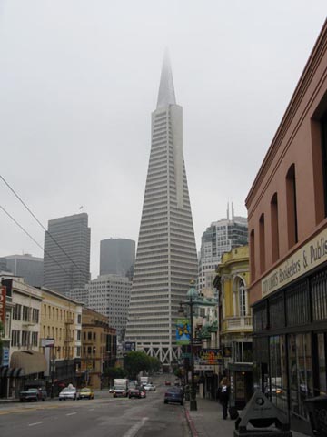
Transamerica Pyramid (added 8/25/08)
Twin Peaks (added 4/3/09)
Union Square (added 8/25/08)
US 101 (added 8/25/08)